In April 2012, at Research Institute for aquaculture No.1,
ICA Project has held a Geographic Information System (GIS) training course . Participating
in the course were Dr. Phan Thi Van, Leader of the Institute, Director of ICA
Project; Dr. Nguyen Huu Ninh, Deputy Director of the Institute; Mr. Nguyen Huu
Nghia, Project Research Coordinator; MsC. and PhD. candidates; local officers
in the target provinces and other project staffs. Lecturer of this training
course were GIS specialist came frome Hanoi University of Mining and Geogology.
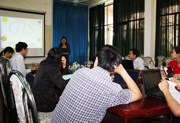
In the first day of the training course, Dr.Phan Thi Van has an opening speech on the importance of this training course for ICA Project and Research Institute for Aquaculture in general. GIS modelling, she said, is one of the most modern and effective visual tools in management . This tool recent year is widely used in the process of decision making, solutions proposals and others. In ICA project, GIS modeling plays an important role in Work Package 2 (W.P 2)- Climate change impact models of major aquaculture systems. In turn, the specialists came from Hanoi University of Mining and Geogology indicates the definition of GIS map as a geographic information system is a system designed to
capture, store, manipulate, analyze, manage, and present all types of
geographical data. The acronym GIS is sometimes used for geographical
information science or geospatial information studies to refer to the academic
discipline or career of working with geographic information systems. In the
simplest terms, GIS is the merging of cartography, statistical analysis, and
database technology. GIS applications are tools that allow users to create
interactive queries (user-created searches), analyze spatial information, edit
data in maps, and present the results of all these operations. Geographic
information science is the science underlying geographic concepts, applications,
and systems.

In the training course, the students were learned to model a
GIS map, to input data into a base map as well as to output the result for the
purpose of presentation, selection and others. Ending the course, students were
given certification of attribution to the training course.
The Geographic Information System training course lasted 5 days
included 2 days for theory, 2 days for practice and 1 day group working.